Data Pickup:
Collect the field elevations using the method that suits you best. Some methods you can use are:
- Import data direct from a wide range of surveying instruments
- Import data from a wide range of other Survey Programs
- Import data from a number of industry standard formats - DWG, LandXML etc
- Import data using a windows compliant digitizer
- Enter data into a traverse table
- Perform geoid corrections
- Perform network least squares solution
- Enter data directly into Excel type tables. Traditional stadia,stadia,level book and level sheet.
- Use feature codes to create layers, strings, points, symbols.
- Comes with predefined symbols, or create your own in DWG format
Cogo Routines:
Collect the field elevations using the method that suits you best. Some methods you can use are:
- Complete range of point manipulation routines:
- Create
- Alter
- Rotate
- Transformations
- Listings
- Complete range of string manipulation routines
- Create
- Edit
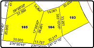
- Adjust by minimum area
- Adjust by crandall,bowditch,least squares
- Unravel
- Reverse
- Add - Drop points
- Circle - Line of best fit
- Listings
- Point calculations
- Bearing & Distance
- Angle & Distance
- Radiate from a point
- Bearing Distance calculations
- Intersection routines
- 2 bearing
- 2 distance
- bearing & distance
- 3 pt rectangle
- Point Calculations with Offsets
- chainage & offset
- distance & offset
- parallel offset
- radiate from an offset
- Curve Calculations
- ip radius
- 3 point
- tangent
- arc / chord
- reverse
- spiral
- route curve - design interchanges, simple curves,equal/unequal spirals
- Road layout calculations
- parallel
- autoroad
- truncations
- equal segments
- Cul-de-Sacs
- Resumption calculations
- Range of reports available
- Quality assurance routines
Contour Routines:
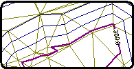
- Use random points and breaklines to form a triangular mesh (TIN)
- Form contours at any intervals you choose
- Annotate contours
- Create and use breaklines
- Interpolate Profiles and Sections
- Calculate Volumes
- Show water run-off
- Show catchment areas
- Export to CAD and rendering programs
Road and Pad Design Routines:

- Create a string alignment for your road or pad
- Show the natural surface and design a profile
- Create a cross-section template using our smart template system
- View our design on-screen in both plan, profile and section view
- Create reports and CAD
- Export our surface
- Create a combined surface for our client